Achill Island in County Mayo is the largest island off the coast of Ireland, and is situated off the west coast. It has a population of 2,700. Achill is attached to the mainland by Michael Davitt Bridge, between the villages of Gob an Choire (Achill Sound) and Poll Raithní (Polranny). A bridge was first completed here in 1887, replaced by another structure in 1949, and subsequently replaced with the current bridge which was completed in 2008. Other centres of population include the villages of Keel, Dooagh, Dumha Éige (Dooega), Dún Ibhir (Dooniver), The Valley and Dugort.
Early human settlements are believed to have been established on Achill around 3000 BC. A paddle dating from this period was found at the crannóg near Dookinella. The island is 87% peat bog. The parish of Achill also includes the Curraun peninsula. Some of the people of Curraun consider themselves Achill people, and most natives of Achill refer to this area as being “in Achill”. There are between 500-600 native Irish speakers in Achill parish.
Places to See on Achill Island
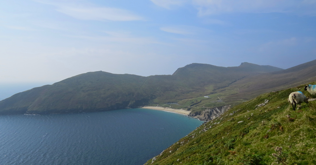
Despite some development, the island retains a striking natural beauty. The cliffs of Croaghaun on the western end of the island are the third highest sea cliffs in Europe but are inaccessible by road. Near the westernmost point of Achill, Achill Head, is Keem Bay. Keel Beach is quite popular with tourists and some locals as a surfing location. South of Keem beach is Moytoge Head, which with its rounded appearance drops dramatically down to the ocean. An old British observation post, built during World War I to prevent the Germans from landing arms for the Irish Republican Army, is still standing on Moytoge. During the Second World War this post was rebuilt by the Irish Defence Forces as a Look Out Post for the Coast Watching Service wing of the Defence Forces. It operated from 1939 to 1945.
The mountain Slievemore (672 m) rises dramatically in the north of the island and the Atlantic Drive (along the south/west of the island) has some dramatically beautiful views. On the slopes of Slievemore, there is an abandoned village (the “Deserted Village”) The Deserted Village is traditionally thought to be a remnant village from An Gorta Mór (The Great Hunger of 1845-1849).
Just west of the deserted village is an old Martello tower, again built by the British to warn of any possible French invasion during the Napoleonic Wars. The area also boasts an approximately 5000-year-old Neolithic tomb.
Achillbeg (Acaill Beag, Little Achill) is a small island just off Achill’s southern tip. Its inhabitants were resettled on Achill in the 1960s.[8] A plaque to Johnny Kilbane is situated on Achillbeg and was erected to celebrate 100 years since his first championship win.[9]
The villages of Dooniver and Askill have very picturesque scenery and the cycle route is popular with tourists.
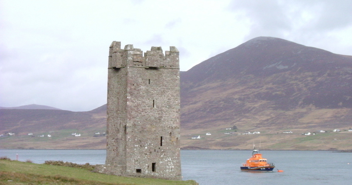
Caisleán Ghráinne, also known as Kildownet Castle, is a small tower house built in the early 1400s.[10] It is located in Cloughmore, on the south of Achill Island. It is noted for its associations with Grace O’Malley, along with the larger Rockfleet Castle in Newport.
Achill Island also has a coast road along the south of the Island with some beautiful cliff views.
For more Information on what’s happening on Achill Island visit:
Source: wikipedia Achill Island